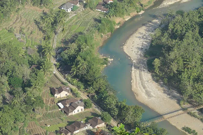
Opak River or Kali Opak is a river along approximately 65 kilometers across Sleman Regency and Bantul Regency, Yogyakarta Province, Indonesia. The upper river is on Mount Merapi in Sleman and flows south to the Indian Ocean on Samas Beach in Bantul.
The Opak River crossed the western side of Prambanan Temple and was once the natural boundary of the Kingdom of Yogyakarta with the Kingdom of Surakarta. The average monthly discharge of water is around 12.35 meters per second with a maximum of 83.2 cubic meters per second and a minimum of 1.89 cubic meters per second.
The major rivers that supply water to the Opak River are Gendol River, Tepus River, Kuning River, Code River, Gajahwong River, Belik River, Tambakbayan River, Nongko River, Oyo River and Winongo River.
This river flows in the southern region of Java in the tropical monsoon climate for the Am code according to the Köppen-Geiger climate classification. The average temperature of a year is around 22 Celsius. The hottest is October at 26 Celsius and the coldest January at 18 Celsius. The average annual rainfall is 2970 mm where January averages 537 mm and September averages 22 mm.
Fish
Opak River water is classified as cloudy, but not necessarily polluted because many living and varied living things include the Suckermouth catfish (Hypostomus plecostomus), Wader (Puntius javanicus), Tawes (Barbonymus gonionotus), Javanese catfish or Lele Jawa (Clarias batracus), Snakehead murrel (Channa striata), and Nilem (Osteochillus hasselti).
Walking catfish or Javanese catfish (C. batracus) are threatened with extinction since the introduction of Dumbo Catfish or Lele Dumbo (Clarias gariepinus) which breed faster and more carnivorous. Opak River is one of the favorite places for fishing enthusiasts in fresh water besides Progo River for residents of Yogyakarta.
Mangrove forest
The Opak River Estuary has a mangrove forest in Baros Village, Kretek District, Bantul Regency and is known as the Baros Mangrove Area. Mangroves grow densely and there is a stretch of grass used by farmers for animal feed. This area succeeded in developing mangrove forests which were previously predicted not to grow on land and environments that did not meet the requirements.

